Climate-driven endemic cholera is modulated by human mobility in a megacity

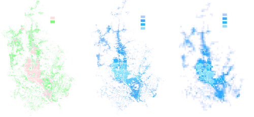
Although a differential sensitivity of cholera dynamics to climate variability has been reported in the spatially heterogeneous megacity of Dhaka, Bangladesh, the specific patterns of spread of the resulting risk within the city remain unclear. We build on an established probabilistic spatial model to investigate the importance and role of human mobility in modulating spatial cholera transmission. Mobility fluxes were inferred using a straightforward and generalizable methodology that relies on mapping population density based on a high resolution urban footprint product, and a parameter-free human mobility model. In accordance with previous findings, we highlight the higher sensitivity to the El Niño Southern Oscillation (ENSO) in the highly populated urban center than in the more rural periphery. More significantly, our results show that cholera risk is largely transmitted from the climate-sensitive core to the periphery of the city, with implications for the planning of control efforts. In addition, including human mobility improves the outbreak prediction performance of the model with an 11 month lead. The interplay between climatic and human mobility factors in cholera transmission is discussed from the perspective of the rapid growth of megacities across the developing world.
